 |
| Buckhorn and Garfias Mountains in the distant |
We couldn’t resist the
spectacular off-road trip in search of Arizona’s “first resort”, Castle Hot
Springs, located 14 miles SE from Wickenburg.
A very popular spot in the 1800’s, this 210-acre resort was a popular
destination for people wanting to escape Phoenix until a fire destroyed the
main building in 1976. We’ve read that
this natural hot springs still produces 180,000 gallons of 118-degree water a
day. It’s was disappointing that we
couldn’t access the original site, but the trek in search of it was
spectacular. The mountain vistas and
wildlife was something that you don’t see every day – all viewed from a dirt
road that made you feel like you were the only person on the planet. How awesome is that?
 |
| Mojave Rattlesnake that greeted us at the start! |
 |
| Wild burro's checking us out. |
 |
| Some unique turns in the road. |
 |
| Free range cattle in the valley |
 |
| Large number of Saguaro cacti. |
 |
| Look close and you can see the dirt road to the left. |
 |
| The winding road keeps going. |
 |
| Rock formations with lots of green. |
 |
| View of Lake Pleasant in the distance. |
Talk about getting up in the
sky as high as 5900 feet in elevation - with breathtaking scenery. This is exactly what we experienced as we set
off on our trip to Sedona which took us through the mountain towns of Yarnell,
Prescott, Jerome, Cottonwood and others before arriving at the red rock
“playground”. Getting there was the
challenge with lots of hairpin turns that those of us in RV’s don’t want to see
and shouldn’t be on. Taking this route
instead of the interstate is definitely a “no-no” for an RV of any size. Although, we did see a 45 ft. motorhome (with
toad) thinking that they were absolutely crazy.
 |
From Congress we start climbing.
 |
| At this point we see Congress way below us |
 |
| Next stop, Yarnell where we stopped at a Bakery. |
 |
| Town of Prescott |
|
 |
| Leaving Prescott area for the vistas in the background. |
As you’re
driving you enter the Prescott National Forest (1.25 million acres) which
borders three other National Forests. At
the lowest elevation you’ll see vegetation of the Sonoran Desert type but as
you begin to climb higher, chaparral, pinion pine and Ponderosa pine pretty
much take up the landscape of these majestic hills. We forge onward with Jeff at the wheel (is
this white-knuckle driving?) and Kay trying to take some awesome photos.
 |
| Just imagine miles of these Pinion Pine trees everywhere. |
 |
| See the road below? We were there and climbing! |
 |
| We definitely see a lot of green at this high elevation. |
 |
| This car passed us (bad car!) |
 |
| Simply beautiful! |
 |
| Starting the descent into Jerome, Arizona |
 |
| Homes situated below the main town of Jerome |
 |
| Outside of Cottonwood, we finally see the red rock. |
Our Sedona
moment finally arrived after driving 110 miles (a little over 2 hours) when we
see red rock in the distant. At an elevation of 4500 feet Sedona is split
almost evenly between privately owned real estate and the Coconino National
Forest. We stopped to get a map for
suggestions of what to see with the Jeep and then decided to do a good hike and
drive the Red Rock Scenic Loop Road before we started the trek back to Congress
(via the Interstate, this time!)
 |
| Magnificent Red Rock everywhere! |
 |
| Path structures were rocky to smooth. |
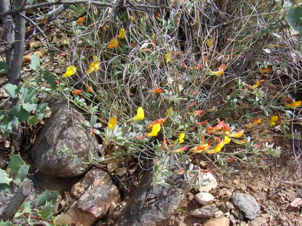 |
| Leave it up to us to find flowers up here! |
As our stay at North Ranch comes to a close, we had to check out the home made pie at the Mercantile in Congress. Then, after we had our desert first, we decided to put in a take-out order for their nachos. Delicious!!!
 |
| Pecan & Apple were eaten (sorry, no pictures!) |
 |
| Jeff getting ready to devour the goodies! |
 |
| (l-r) Steve (from WA), Rebecca (from CO) and Jeff |
We definitely
will return at another time in our travels. We met new friends and have many good memories of this beautiful place in America!
Hugs to all ~ Kay & Jeff
Travel Update: We will be leaving North Ranch on 3/24
heading to the Lost Dutchman State Park outside of Apache Junction,
Arizona. We have reservations at the SP
and will enjoy meeting up with relatives who winter in Apache Junction. Our next adventure just could be Canyon de Chelly National Monument in
northeast Arizona. At an elevation of 5000-6000 ft it's still a little chilly! We have to start
thinking about the trek home at some point, don’t we?


No comments:
Post a Comment
Thanks for taking the time to comment on our blog. We do appreciate it!